From the Affinity Projects Wiki
FIT Wellington: A New Public Transport Approach
Introduction
FIT stands for Fair, Intelligent Transport. We are a group of Wellingtonians who want to see a change in transport priorities so the private motor vehicle no longer dominates other transport modes. We want to see a city designed for people, not cars. Our vision for Wellington is a modern, vibrant city which includes:
- A healthy and safe city where the unique character and beauty of our harbour capital is enhanced by the built environment, including its transport system;
- A city that has reliable, low-cost, fast and convenient public transport, that takes people where they want, when they want; and
- A city where walking, cycling and electric public transport are actively promoted to reduce transport costs, improve health by physical exercise and reduce pollution and climate change effects.
In collaboration with Generation Zero, we have reviewed the latest business plan for the development of public transport in Wellington.
We consider there are grave deficiencies in the proposals for BRT (Bus Rapid Transit) and the spine study on which it is based. In particular, the underlying assumptions adopted for light rail in the spine study inevitably gave a high-cost, low-benefit option. We believe these assumptions are no longer appropriate.
We believe that the spine study identifies the wrong route for rapid transit from the CBD (Central Business District) to Kilbirnie. We also believe that alternative routes exist which avoid the choke point at the Basin Reserve, and that light rail would provide a far more cost-effective solution than the BRT currently proposed. The body of this report presents evidence to support this view.
This report presents options for light rail through central Wellington to Kilbirnie and on to the Airport, together with a supporting bus network. We acknowledge that there are other route options for light rail than those presented here; in particular, we recognise the desirability of operating along the full length of the golden mile. A route via the Basin Reserve would also be feasible.
With the introduction of light rail along one of the identified routes, buses in the central city can be reduced to manageable numbers.
Comparing BRT and light rail
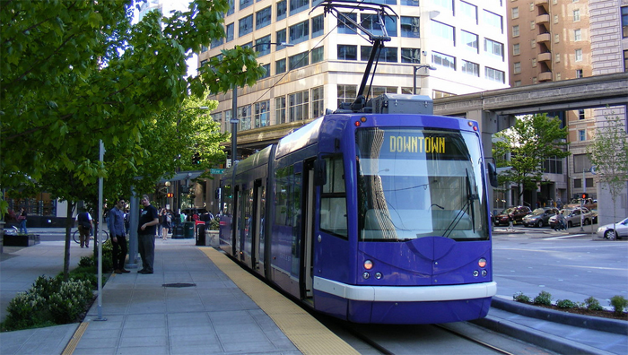
BRT for Wellington will not be rapid and will not meet the minimum internationally adopted standard [1] requirements for a bus system to qualify as BRT. We expect that light rail in Wellington will be cheaper than the street-widening and amenity costs of BRT.
BRT is an effective solution in many cities. The problems in Wellington are:
- its narrow and winding streets; and
- the need for large cumbersome buses to gain capacity—these pose dangers for other road-users.
High capacity also demands frequent buses, which are too easily slowed by delays at traffic signals or bus stops. BRT needs a high priority at traffic signals (or a flyover) and overtaking lanes at stops. BRT can be space-intensive; for example, BRT stops in Brisbane are nearly twice the width of Manners Mall (27m versus 15m).
Peak capacity for light rail running on-street is about 40 trams an hour: lower than for buses because there is rarely space to berth two trams at a stop. Light rail capacity depends on vehicle capacity rather than frequency, carrying around 300–400 people in Wellington. Even a few buses sharing a light rail route will disrupt route capacity, but excluding all buses from the central city may not be possible: Wellington needs a second route for the remaining buses.
Planned, near-seamless transfers at quality interchanges are necessary for light rail in Wellington, and all quality, city-wide systems. Transfers will dramatically reduce bus-kilometres, mainly on the golden mile, allowing more and better services on remaining routes. Good design of interchanges and timetables minimizes transfer times (generally 2–5 minutes),1 making many trips faster overall.
Transfers are a successful and uncontroversial feature of most overseas public transport systems, including those using BRT. The claimed unpopularity of transfers in Wellington is based on unsatisfactory questions posed in the spine study without balancing information. This approach unnecessarily biased respondents against transfers, e.g.
- Do you want to break your existing journey by making a transfer?
- Do you want faster, cheaper and much more reliable trips, anywhere-to-anywhere?
Of course nobody wants transfers if they can avoid them. But no information was given on how the inconvenience can be minimized or mitigated when combined with modern light rail. Respondents will have in their minds the painfully slow and erratic transfers experienced in Wellington.
And, of course, everybody wants faster, cheaper and much more reliable trips anywhere-to-anywhere, but can be put off by biased questions. This bias compromises the validity of the spine study’s conclusions.
Light rail in Wellington
This section presents options for light rail from Wellington Railway Station to the Airport, via Wellington Hospital.
Design principles
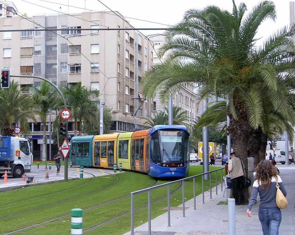
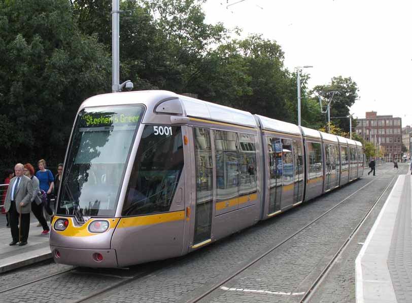
Light rail is a form of public transport providing fast, efficient, clean service to people in urban areas. It uses electric vehicles, running on tracks in existing roads, separated from other traffic. It’s designed to carry lots of people, with connections to buses and suburban trains at major interchanges.
French public transport planners have developed what they refer to as The Art of Insertion. The art of inserting light rail into a city like Wellington requires embracing five design principles [2]:
- Tie the city together.
- Light rail lines typically extend from urban fringe to urban fringe via the city centre.
- Use high-performance transit vehicles.
- That means large capacities, all-door entry, train-style off-board (e.g. on-platform) fare payment, level boarding, and signal priority at intersections.
- Have widely spaced stops.
- Light rail stops are spaced far enough apart to improve travel times, but they’re placed at critical transfer points with feeder buses or other major lines.
- Reach major destinations.
- A given for good public transport, but light rail lines emphasise access to education campuses, office complexes, hospitals, and shopping areas, in addition to major suburbs and the CBD.
- Form the core of an integrated public transport network.
- Bus lines are reconfigured to serve major light rail stops, and fare programmes encourage easy transfers from mode to mode, including suburban rail services.
Route options
We have identified feasible and affordable options for light rail and a supporting bus network. We are confident that we have workable options, combining buses and light rail, but have not identified a best or preferred option. We propose buses and light rail on fully separated routes, both on or close to the golden mile.
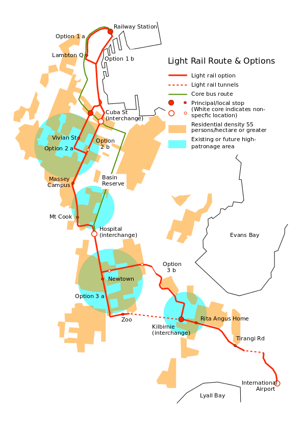
We have identified a single light rail route from the Railway Station to Wellington Hospital, Kilbirnie and Wellington Airport, with options in three places: south of the Railway Station; the Michael Fowler Centre; and Wellington Hospital. Only the last option, 3a or 3b, will materially affect costs. See Light rail route and options.
Summarising the benefits of light rail as suggested here:
- Speed throughout the route, with an indicative travel time to the Airport of 20–25 minutes at any time of day.
- The best service provided where demand is greatest: the Te Aro mixed use development area; high residential density and education destinations in Mt Cook; existing and planned residential density around Adelaide Road; Wellington Regional Hospital; high-density mixed-use in Newtown; high residential density and planned revitalization in Kilbirnie.
- Excellent timekeeping at all times of day, which makes consistent timetables and timed transfers practical.
- Very smooth ride. A common sight on light rail is passengers standing when there are plenty of seats.
- Quiet, with zero emissions from the vehicle and almost carbon-free running on electricity from renewable sources.
The identified route does not run by the Basin Reserve, although it is within the area defined in the N2A (Ngauranga to Airport) study. Recent events suggest difficulties in finding a reserved route, and multi-segment trams can be difficult on large, multi-lane roundabouts. This corridor is more suited to buses, with no particular reason to run a high-capacity route that way.
Central city
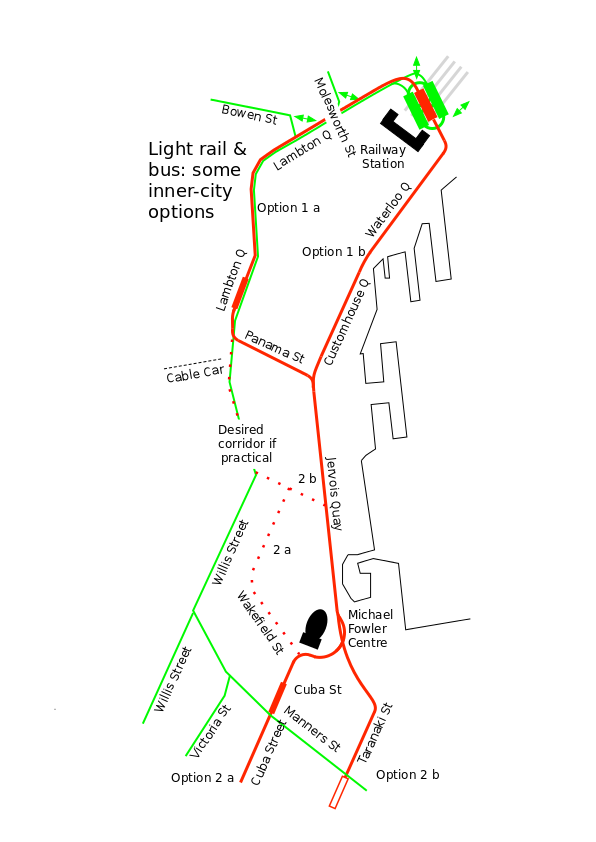
At the city end, we propose two alternatives; see Inner City Map, options 1a and 1b:
- either a dedicated right of way on the west (Terrace) side of Lambton Quay, crossing to Jervois Quay at Willeston Street (if practical) or Panama Street;
- or a waterfront route along the east side of Customhouse Quay.
Principal considerations in deciding between options will be vehicle speed, walking distance and passenger numbers walking. Further investigation is needed to determine whether a dedicated light rail route on Lambton Quay south of Panama Street is feasible, as this would require removing buses from this part of Lambton Quay. Such a route would then follow Willeston, Victoria and Wakefield streets to Cuba St (option 2a) or Willeston St to Jervois Quay and Taranaki St (option 2b). We have identified this as a desirable route, but do not have enough information to determine feasibility and cost.
In the southern CBD we propose either a Cuba St route or a faster route via Taranaki St (options 2a and 2b); Wallace St with access to Wellington High School and Massey University; then on to Newtown via John and Riddiford Streets via Wellington Hospital. This route, running west of the Basin Reserve, would be better aligned with the light rail design principles, with more opportunities at the Hospital and through Newtown. The curves in the John St area mean slightly reduced operating speeds.
South of Wellington Hospital we propose a route to Kilbirnie by either Wellington Zoo or Constable Street and Crawford Road (options 3a & 3b). In each case the proposed Kilbirnie interchange is on commercial land at Coutts Street, opposite Bay Road. These options have important cost effects, because of tunnels: option 3a will cost an additional $212 million. This area is discussed further in Indicative costs.
Kilbirnie and the Airport
The main advantage of a Constable Street route is cost because it bypasses the longest tunnel. The main disadvantages are loss of patronage in the denser Newtown area, and a more difficult route in Kilbirnie.
For option 3a we propose a single-track tunnel to Kilbirnie. Single track is justified because the heaviest light rail traffic will be in the city centre and a reduced service can be justified south of Wellington Hospital. Tunnel capacity should be at least 12 trams an hour each way, or say 3500 passengers an hour. This is an initial estimate and can probably be increased after timetable modelling. A second tunnel will be needed if capacity is ever reached.
Either option will require a tunnel beneath the airport runway. A single-track tunnel will be satisfactory for option 3b, but option 3a may need a two-way layout. This can be checked using timetable modelling but is assumed at this stage.
Constable Street is not particularly difficult for light rail (eastbound traffic can be diverted by Mein and Coromandel Streets, which is already a rat-run), but Crawford Road presents two challenges:
- Managing westbound traffic reaching Constable Street, to control queue-lengths at traffic signals and minimize peak-hour delays to westbound trams.
- The lower end of Crawford Road, which is less than 11 metres wide.
Bus services
Buses would fill several essential roles:
- Full service on short routes incompatible with transfers, such as Brooklyn; Mt Victoria; Aro Street or Kelburn; or busy corridors requiring two transfers.
- A “virtual” regular service from the Railway Station to Courtenay Place, for passengers wanting closely-spaced stops. This would be several routes timed to collectively provide a consistent service: say every five minutes.
- Possibly a full service on some longer routes such as Karori. In this case the route should probably pass through the Railway Station interchange, if not terminate there.
These needs will have to be “rationed”, to manage a peak-hour maximum of 60 buses an hour on all routes (for congestion-free running) and the cost of running buses and light rail in competition. Other bus services would terminate at one of the interchanges.
The first light rail line in a new city typically takes 10 years from the go-ahead: the existing bus route will need alterations to boost capacity until light rail can take over.
Indicative costs
Light rail costs have fallen in recent years, and last year the International Railway Journal quoted €25–30m per kilometre for a typical line in France: NZ $42–51m/km. Now Besançon, France has opened a new line for €17.5m/km: $30m/km. Using these figures as a guide, we consider the costs set out in Comparative costs of options 3a and 3b are reasonable. We have assumed:
- an all-up cost of $40 million per route kilometre (including depot and vehicles but excluding tunnels)
- a further 20% for design and a contingency allowance
- all interchanges can be built within this all-up cost, bearing in mind the increase in value of residential development around a main interchange
- all costs exclude GST
| Stage | Cost item | 3a | 3b |
|---|---|---|---|
| Railway Station to Hospital | |||
| 3.8km @ $40m/km | $152m | $152m | |
| Design & contingency (20%) | $30m | $30m | |
| Total | $182m | $182m | |
| Hospital to Kilbirnie | |||
| 2.3km @ $40m/km via Zoo | $92m | − | |
| Single-track tunnel beneath Mt Albert: 720m @ $200k/m | $144m | − | |
| 2.2km @ $40m/km via Constable St | − | $88m | |
| Design & contingency (20%) | $47m | $18m | |
| Total | $283m | $106m | |
| Kilbirnie to Airport | |||
| 2.1km @ $40m/km | $84m | $84m | |
| Double track tunnel beneath runway: 250m tunnel @ $300k/m | $75m | − | |
| Single track tunnel beneath runway: 250m tunnel @ $200k/m | − | $50m | |
| Planning, design & contingency (20%) | $32m | $26m | |
| Total | $191m | $156m | |
| Grand Total | $656m | $444m | |
| Plus GST | $98m | $67m | |
This proposal should be relatively inexpensive to build, given good project management and good control of nice-to-have costs:
- No costly structures needed, other than tunnels, costed separately. The heaviest other cost will be Wellington Railway Station.
- A waterfront route would push down costs because it avoids the worst areas for costly underground services diversions.
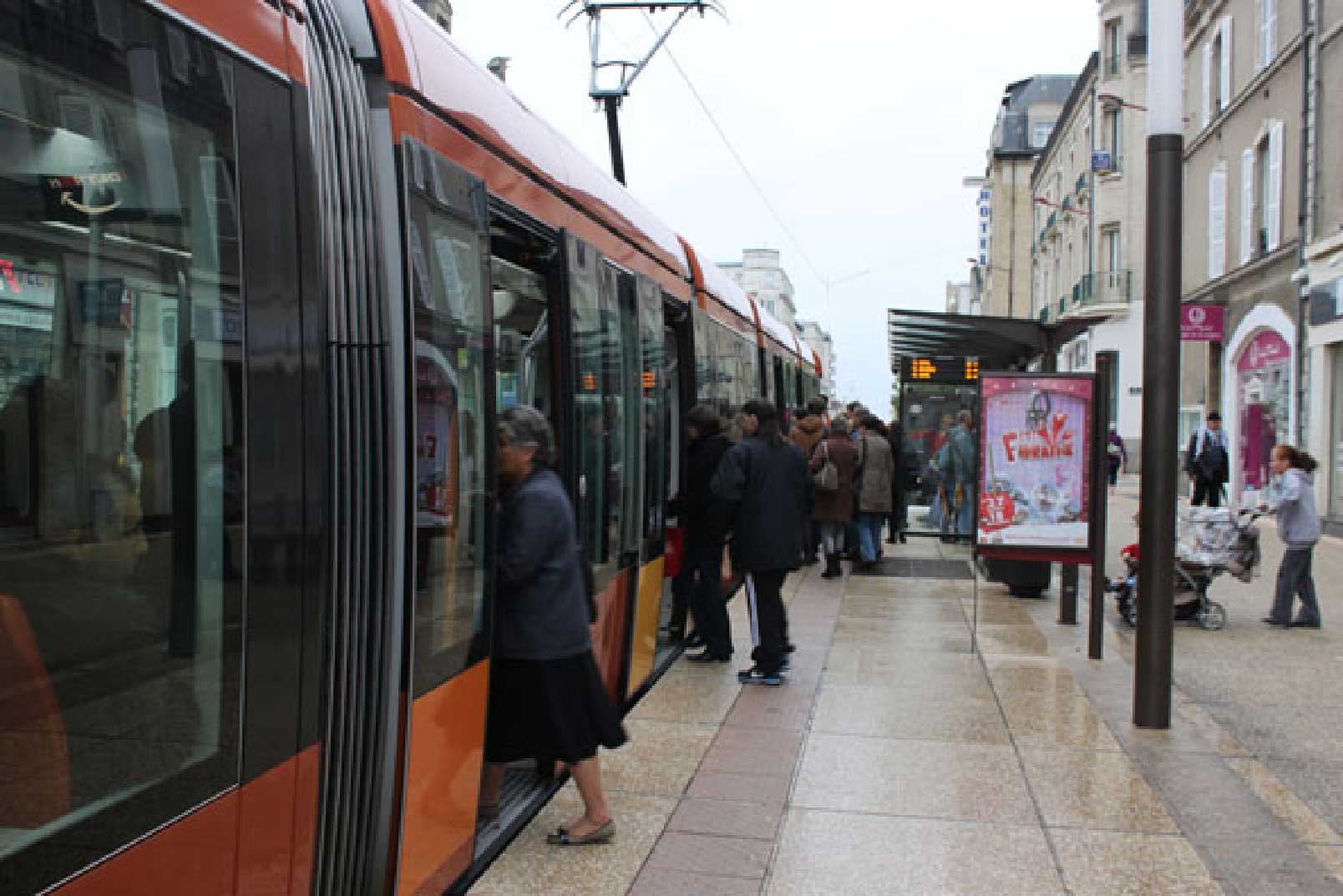
- Other cities have reduced costs up to 20% using joint procurement (Amiens and Caen for example) and Wellington may be well-placed to do the same by pairing with Auckland.
At this stage tunnelling costs are based on five assumptions:
- Ground conditions are such that the tunnelling cost estimated for Mt Victoria is applicable.
- A single-track tram tunnel costs $200,000 per metre under these conditions .2
- Reaching capacity in the Mt Albert tunnel is sufficiently far into the future to justify an initial single-track tunnel.
- A single-track tunnel under the airport runway will be sufficient for option 3b. Option 3a is likely to need double-track, because of the timetable effects of two nearby single-track tunnels. This can be confirmed by modelling at the design stage.
- Instead of two runway tunnels, a single larger tunnel with a central fire-wall will be sufficient, at an assumed saving of 25% overall.
We acknowledge there are challenges in the Constable St option, but are confident that the engineers could find workable solutions. Clearly, the cost saving would be considerable—enough to fund over 4km of light rail construction, such as a line to Island Bay. A detailed study will be needed to determine which option is best value for money.
Next steps
We seek support to:
- Include a light rail option in the full BRT business case for assessment by Councillors and the public, based on this new information.
- Engage in constructive and collaborative discussion with officials of the options presented here, with a goal of light rail to the airport by 2030.
- Promote informed public discussion of transport options for Wellington, including light rail.
1 2009 Opus survey and 2011 Bus Review (↑)
2 Option Cost Analysis, page 8 (↑)
Copyright © 2026 the Affinity Projects wiki and its authors — Attribution ShareAlike
Links
Retrieved from http://intranet.affinity.co.nz/projects/FITWellington/ANewPublicTransportApproach
Page last modified on 21 October 2015 at 11:04 AM
